Satpara Lake
Skardu, Gilgit-Baltistan, is a very beautiful place in Pakistan.
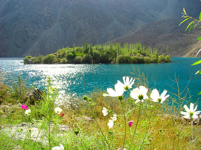
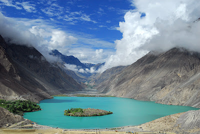
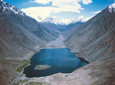
There are many lakes in this area one of which is Satpara Lake a natural lake near Skardu, Gilgit-Baltistan, Pakistan, which supplies water to Skardu Valley.
It is fed by the Satpara Stream.Satpara Lake is situated at an elevation of 2,636 meters (8,650 ft) above sea level and is spread over an area of 2.5 km². Satpara Lake is one of the largest fresh water lakes in the country offering trout fishing, and row boating. The lake is 9 kilometers from Skardu, capital city of Baltistan, and takes about 20 minutes by jeep to reach. Another one hour drive by jeep will take you up to an altitude of 16,000 feet and finally to the second largest plateau in the world, popularly known as Deosai Plain.PTDC’s newly built motel is ideally located near Satapara Lake.
 |
| Satpara Lake |
Satpara Dam is an under-construction medium-size multi-purpose concrete-faced earth-filled dam located downstream of the existing Satpara Lake on the Satpara Stream approximately 4 km from the town of Skardu in Gilgit-Baltistan, Pakistan. Construction of Satpara Dam commenced in April 2003 and is scheduled for completion in November 2011. Power House No. 1 was completed and came online on 6 October 2007 and Power House No. 2 was completed and came online on 30 December 2008. On 7 January 2011, the Government of Pakistan and the United States Agency for International Development (USAID) entered into an Enhanced Partnership Agreement under which USAID agreed to provide US$ 26 million for the construction of Power Houses Nos. 3 and 4 and completion of remaining works on the dam. Upon completion, the dam will enlarge the size of Satpara Lake, generate 17.36 MW of hydroelectricity and supply power to approximately 30,000 households in the Skardu Valley, irrigate 15,536 acres (62.87 km2) of land and supply 3.1 million gallons per day drinking water to Skardu city. Annual agricultural output in the Skardu Valley is expected to increase more than four-fold, generating about $6 million in additional annual economic benefits to local communities.
 |
| Satpara Lake |
 |
| Satpara Lake |
Nine kilometers south of Skardu is beautiful Satpara Lake,
brilliant blue and stocked with rainbow trout, but no longer pristine. The
construction of two power stations as well as a dam that will raise the level
of the lake was still very much under way at the time of research. It is
expected that most of the vegetated foreshore and the picturesque island will
be submerged. The hotels have already moved up the hill. The walk to the lake
is a dry, moderately steep three-hour (8km to 9km) climb up Hargisar Nala from
the bazaar. Or you can take the road which is currently choked with trucks and
construction vehicles. Ultimately, there will be a paved road to the lake and
continuing to the Deosai Plains. Deosai Plains information will be given in the next Post.
 |
| Deosai Plains |
Across Hargisar Nala from the track is a Buddha relief
carved on a rock in about the 7th century. About 200m beyond the Baltoro
resthouse turning and a cluster of government offices, and just past an Aga
Khan Rural Support Program (AKRSP) office, turn right on a small path. Near the
end of this is a footbridge across the nala, and a track up to the
Buddha. There and back is a detour of about an hour.
A road, parts of it already paved, runs past the lake and
6km to 8km on to Satpara village. Roughly 25km beyond the village, the track
crosses the Ali Malik Mar pass onto the Deosai Plains. The most popular
trekking route goes from Skardu up Burji Nala, to the west of Hargisar.
I hope
you liked the information.
For details about how to get in Pakistan please visit my
post Language and how to get to Pakistan:
Please like and comment if you have any additional
information ot share about Satpara.
.jpg)

Comments
Post a Comment